The Only Way Left to
Observation Point
The classic route from Weeping Rock has been closed since 2023. The East Mesa Trail is now the only way up — and most guides still haven't caught up to that. Here's what's actually true, from a trip we did ourselves.
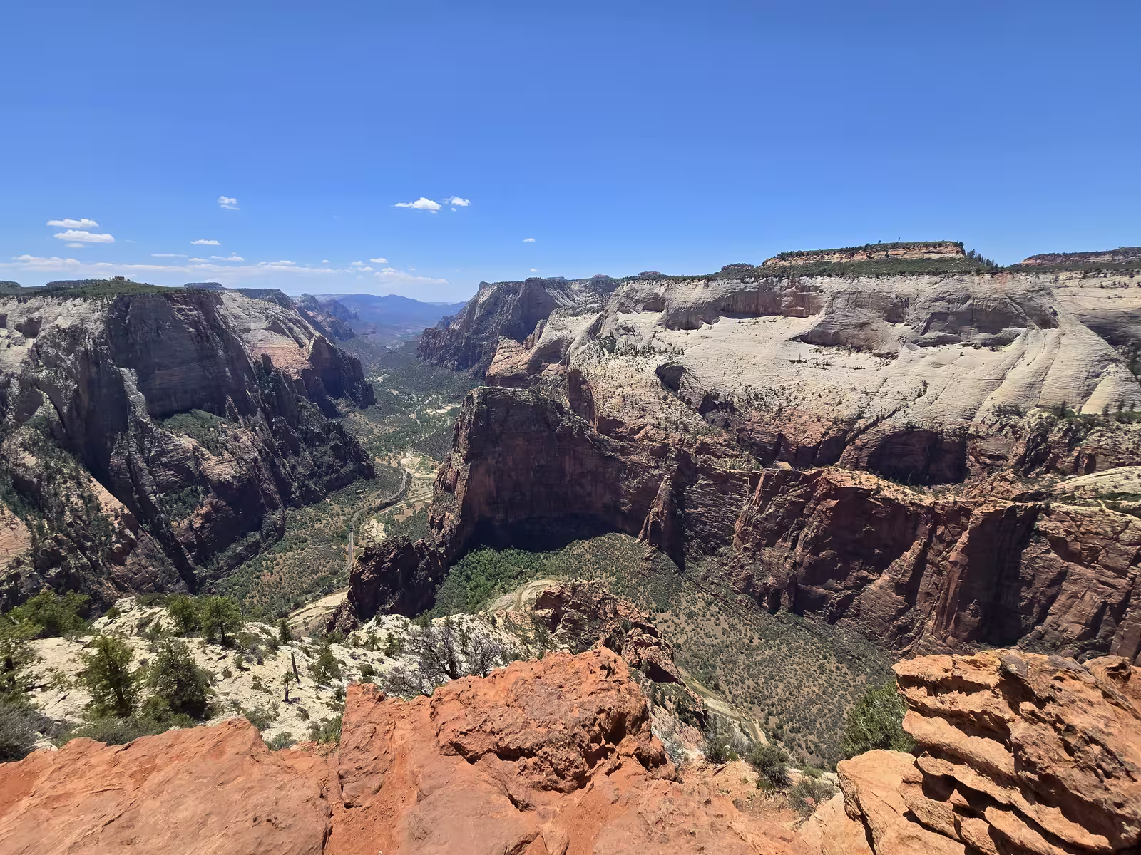
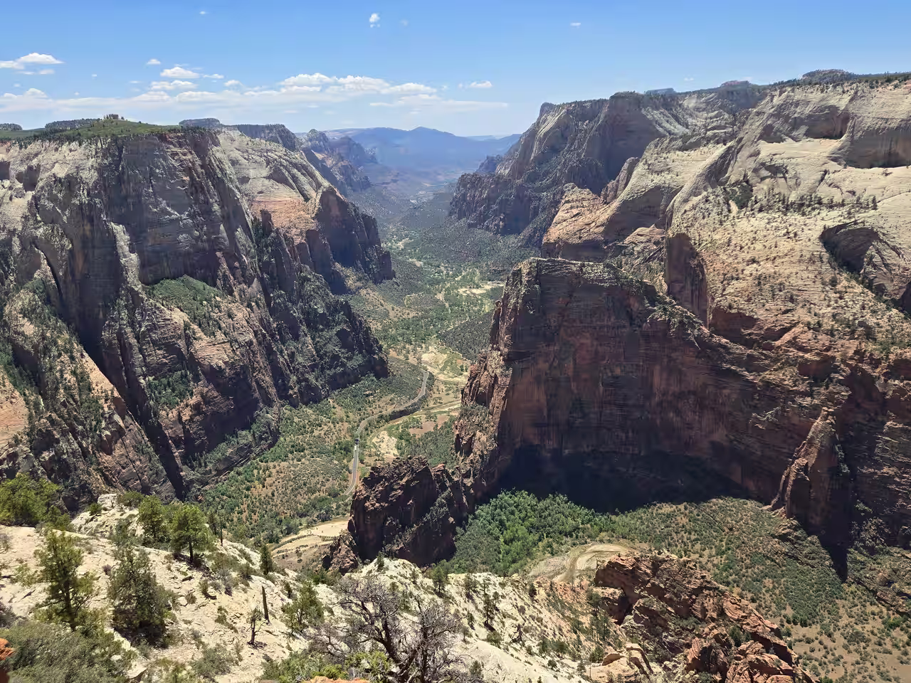
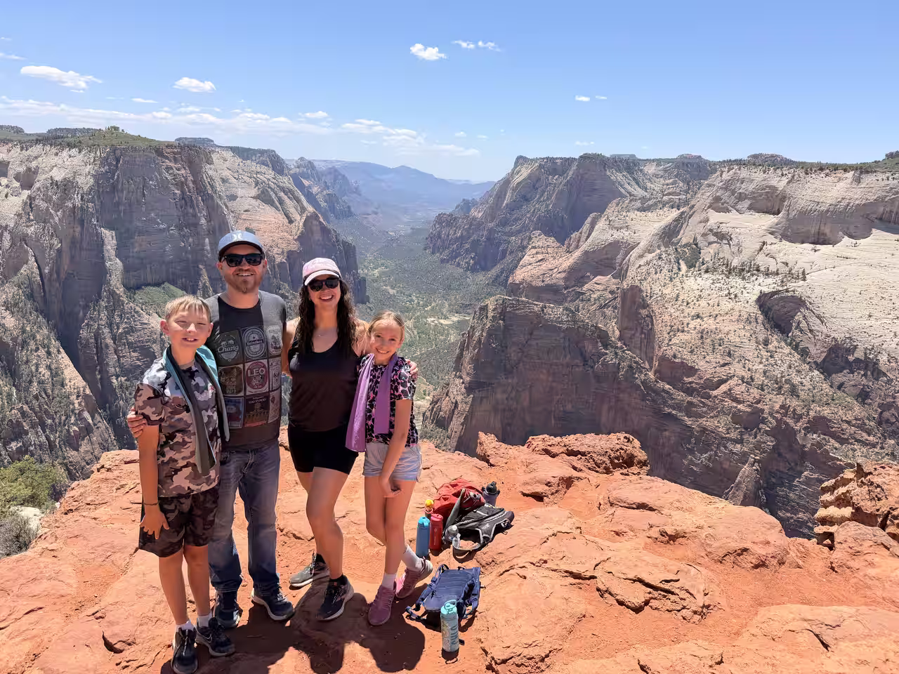
Observation Point is the best view in Zion National Park — full stop. You're 2,000 feet above the canyon floor looking straight down at the Virgin River, Angels Landing sitting small below you, the Great White Throne filling the skyline. For years the classic way up was from Weeping Rock. That trail has been closed since a 2023 rockfall, with no reopening date announced. The East Mesa Trail, starting outside the park near Zion Ponderosa Ranch Resort, is now the only way to get there. We hiked it ourselves over Memorial Day weekend. Here's what we'd actually tell you.
A lot of what's written about this hike is stale or second-hand. Some guides still describe the Weeping Rock approach like it's an option. Others repeat "high-clearance 4WD required" for the access road without ever having driven it. We drove it, hiked it with our kids, and we're telling you what we found — including the one part of the road that actually deserves the warning.
At a Glance
Why East Mesa Is the Only Way Up Now
The route most people picture when they think of Observation Point — up from Weeping Rock, through the switchbacks on the East Rim Trail — closed after a major rockfall near Echo Canyon in November 2023. It's still closed. There's no announced timeline for reopening, even after the separate, shorter Weeping Rock Trail itself reopened in September 2025. Those are two different trails sharing a name with the same trailhead, and the confusion trips a lot of people up when they're trying to plan.
The East Mesa Trail starts from a completely different spot — outside the park boundary, accessed through Zion Ponderosa Ranch Resort on the plateau above and east of the main canyon. It's been the only way to reach Observation Point for a while now, and most likely will stay that way for the foreseeable future. The good news: it's actually an easier hike than the old route. Where the East Rim approach gained over 2,000 feet in punishing switchbacks, East Mesa gains about 700 feet across mostly flat, forested terrain. You're trading some drive-time hassle for a genuinely gentler trail.
Getting to the Trailhead — The Honest Version
This is the part most guides get wrong, usually because they're writing it from the Springdale side. Coming from Starlit Ridge, you skip Springdale, the park's south entrance, and the Zion-Mt. Carmel Tunnel entirely. Drive south on US-89 to Mt. Carmel Junction, then west on UT-9 toward the park's east entrance. The East Mesa turnoff comes before you'd actually need to pay the park entrance fee, since the trailhead sits outside the boundary.
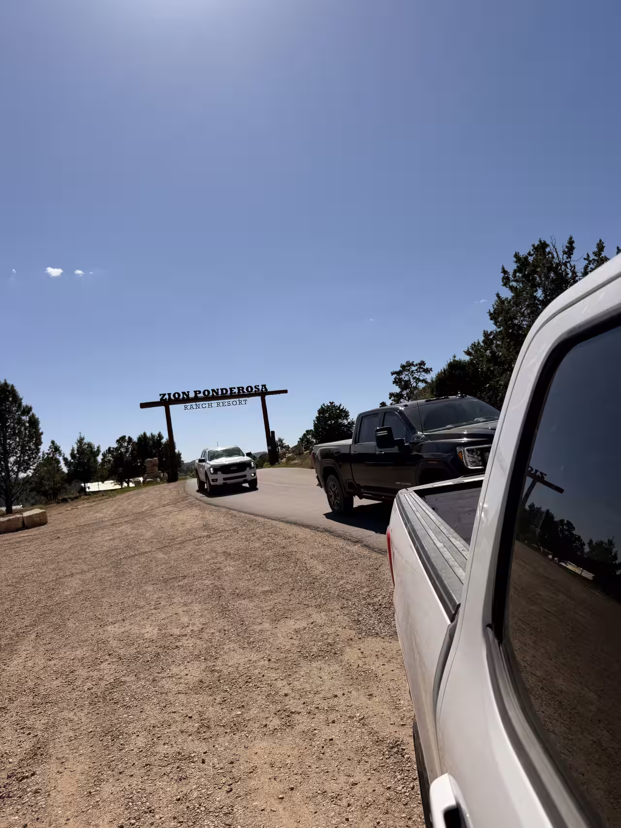
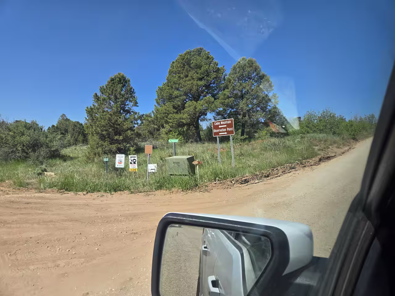
Watch for North Fork Road heading north off UT-9 a short distance past the east entrance area. Follow it through the gate at Zion Ponderosa Ranch Resort — you're driving through private resort property for the next few miles, so take it slow and be considerate of guests, horses, and ATVs sharing the road. Past the resort, the pavement ends and a sequence of turns (well-signed at each junction with small brown "Observation Point" arrows) leads you through Twin Knolls Road, then onto the home stretch toward the trailhead.
Here's the actual road condition report: most of it is a normal, well-graded dirt road. If you made it to Starlit Ridge on our own gravel road, you can make it to this trailhead in good weather, in a regular car. We drove out in a Toyota RAV4 and parked next to a Tesla Model Y — neither vehicle built for off-roading, both made it without issue.
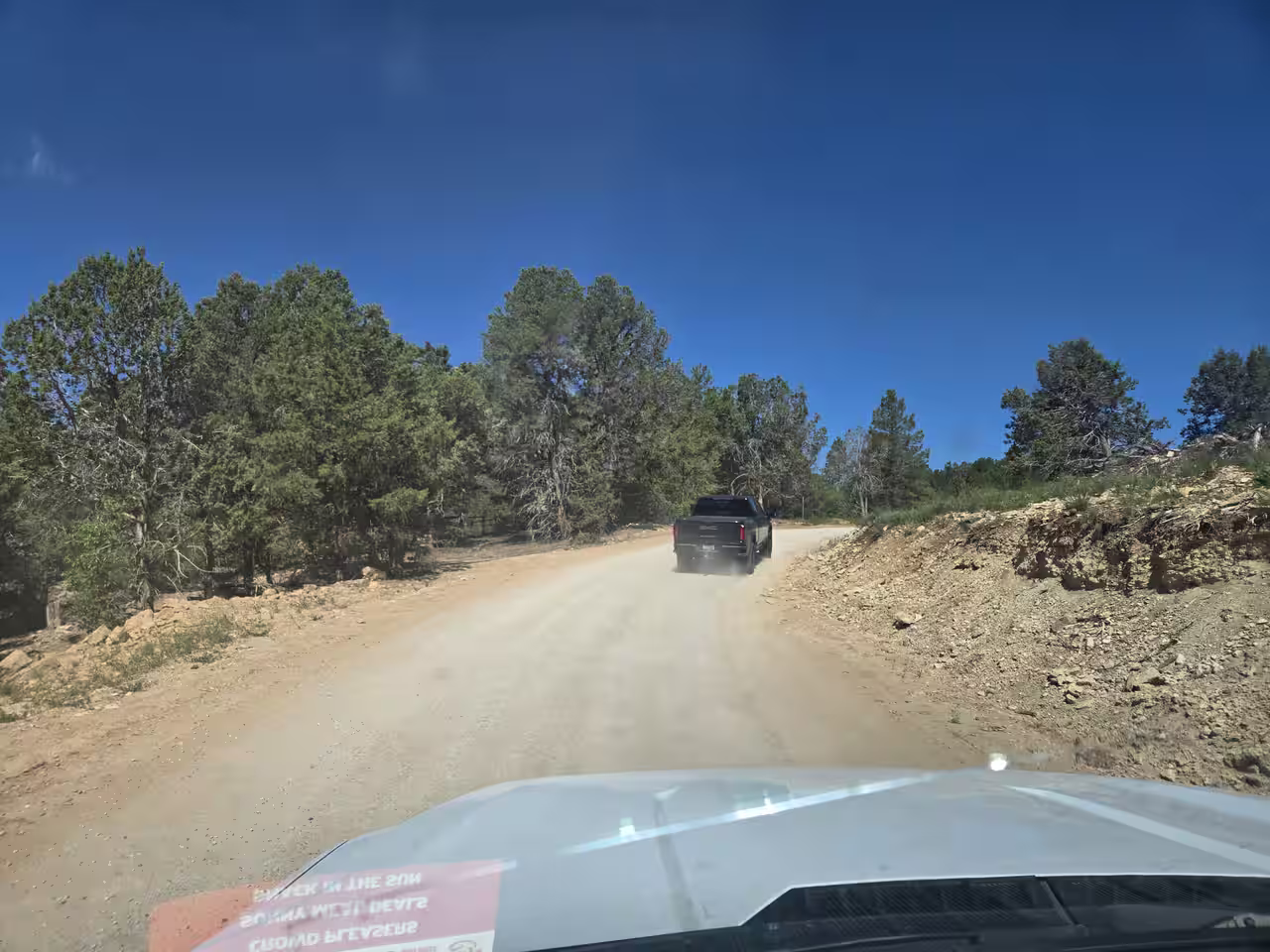
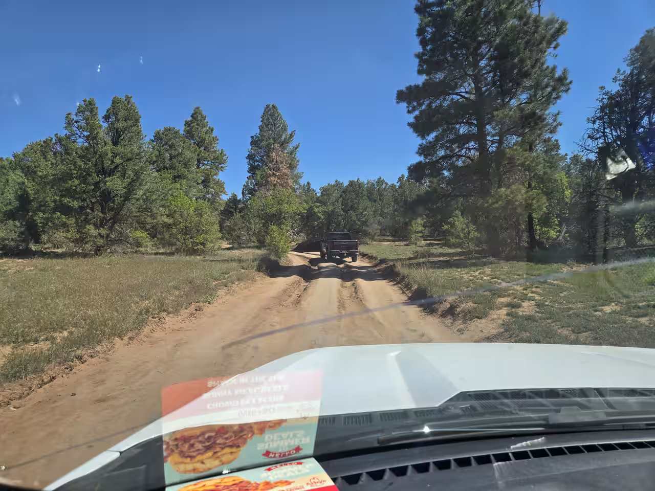
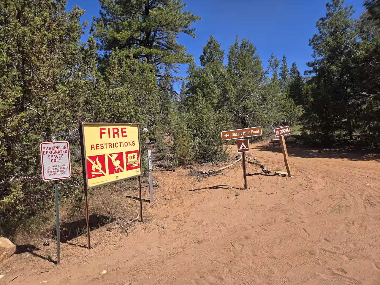
Follow the signs at each junction rather than trusting GPS blindly — cell service is unreliable out here, and the NPS has done a decent job marking the route with small brown directional signs once you're past the resort gate.
The trailhead lot is small and fills up on weekends and holidays. Arrive early, especially in summer when you'll also want the cooler morning temperatures for the hike itself.
The Trail Itself — Why It Doesn't Get Boring
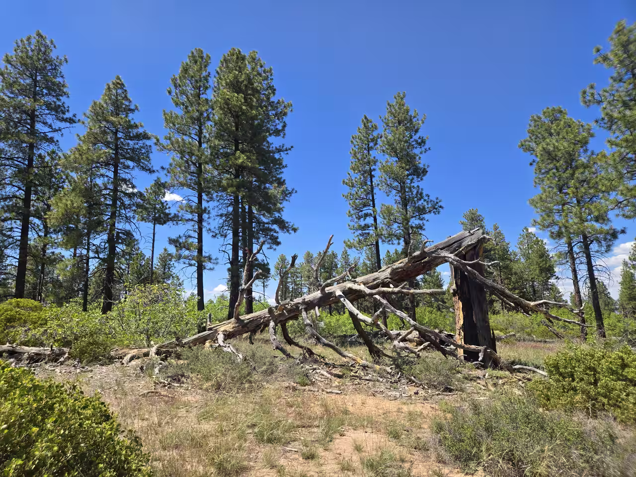
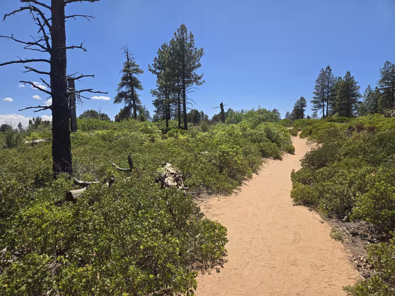
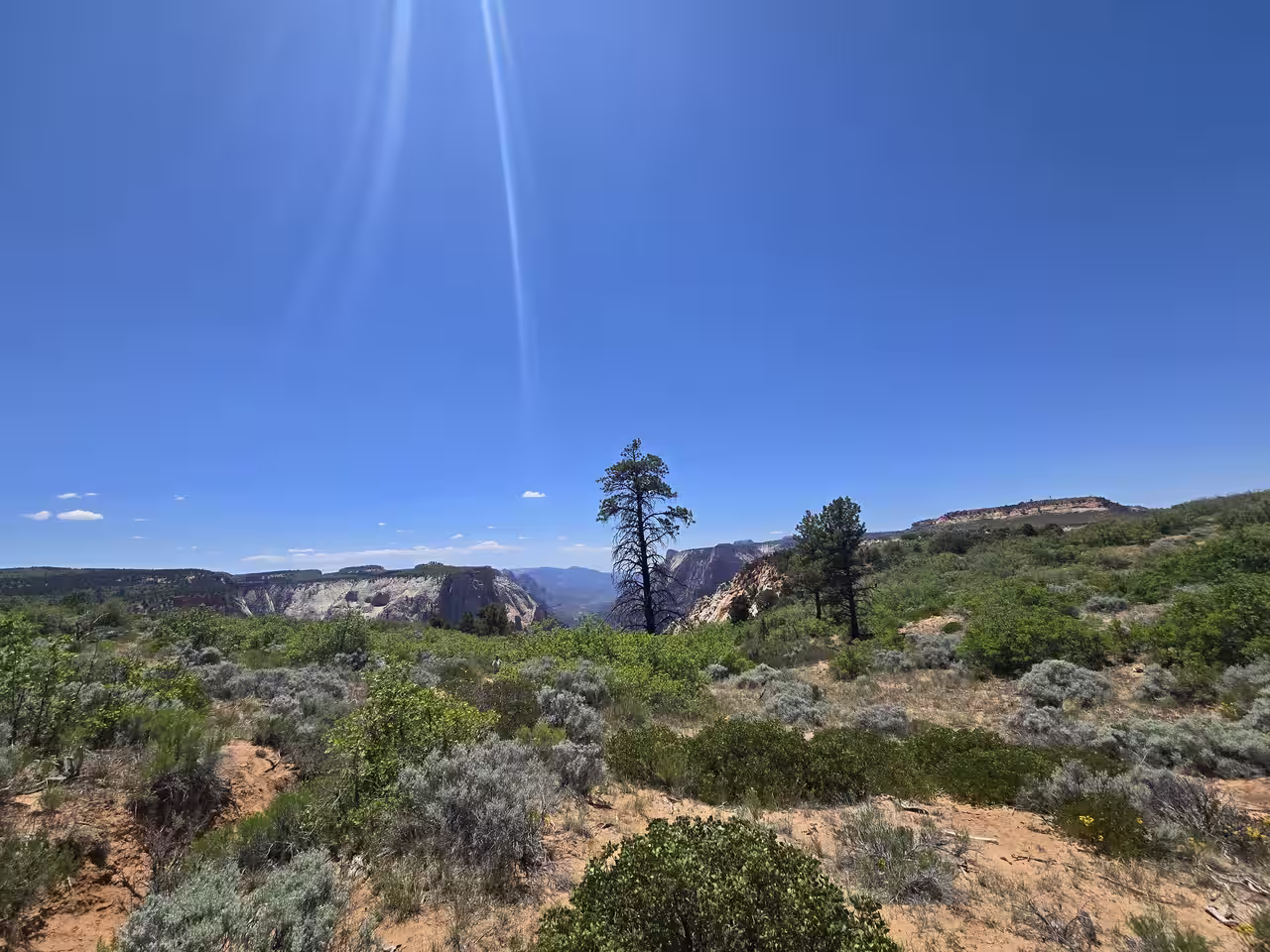
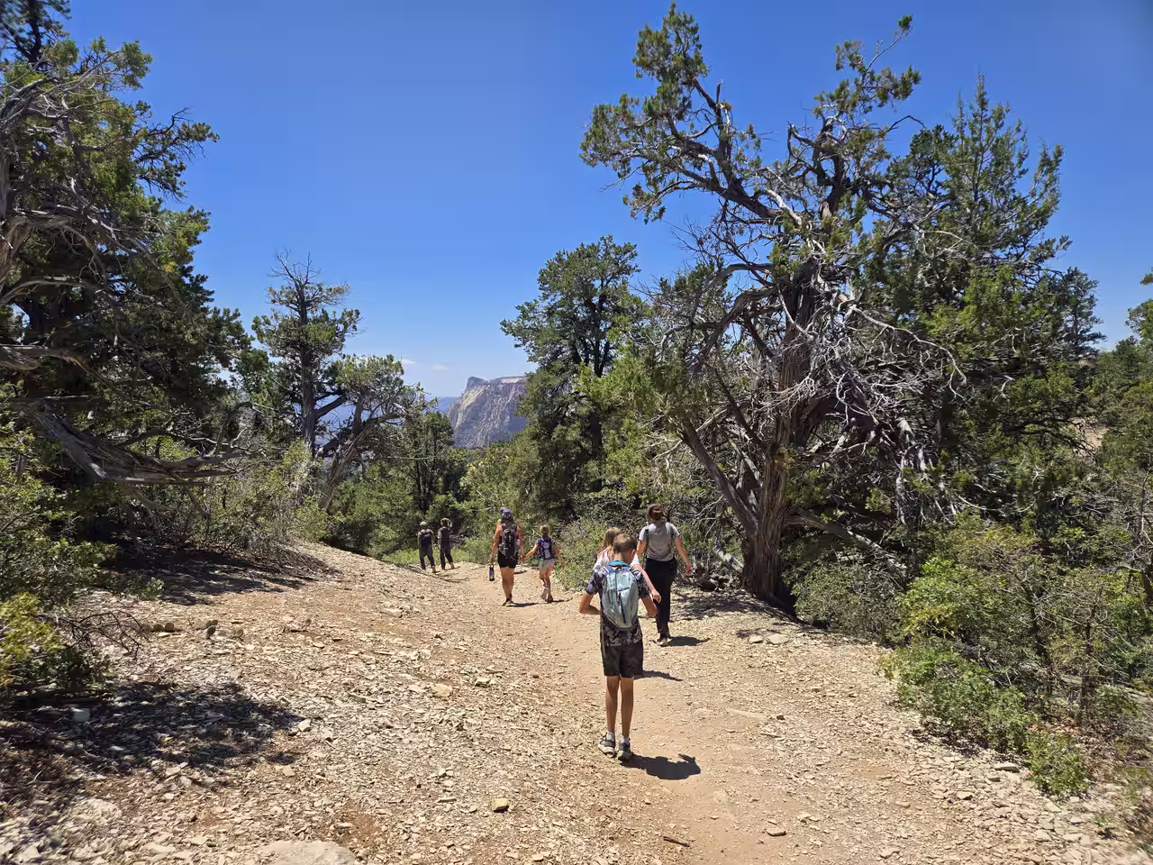
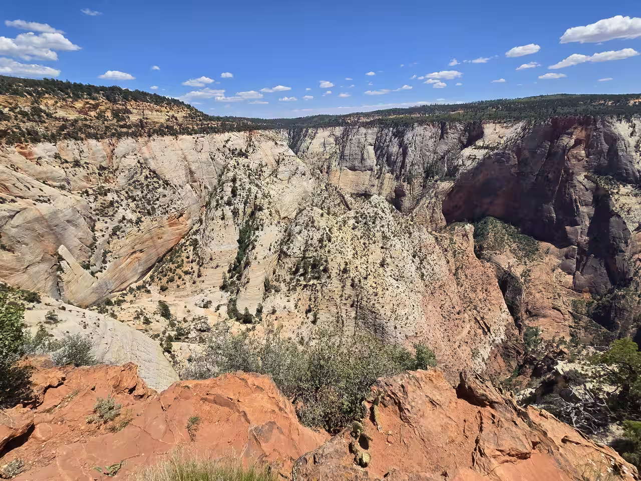
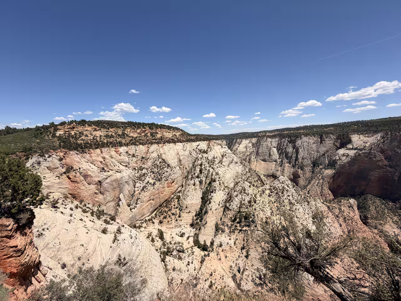
A lot of write-ups call East Mesa monotonous — "flat and featureless," one guide put it. We didn't find that. The terrain actually shifts more than most Zion trails: you start in deep ponderosa pine shade, move through tight scrub oak corridors, open into desert scrub with cactus and yucca, and finish across open meadow before the rim. Four distinct moods in 3.3 miles. That variety is the trail's real selling point, and it's the part most generic guides skip past.
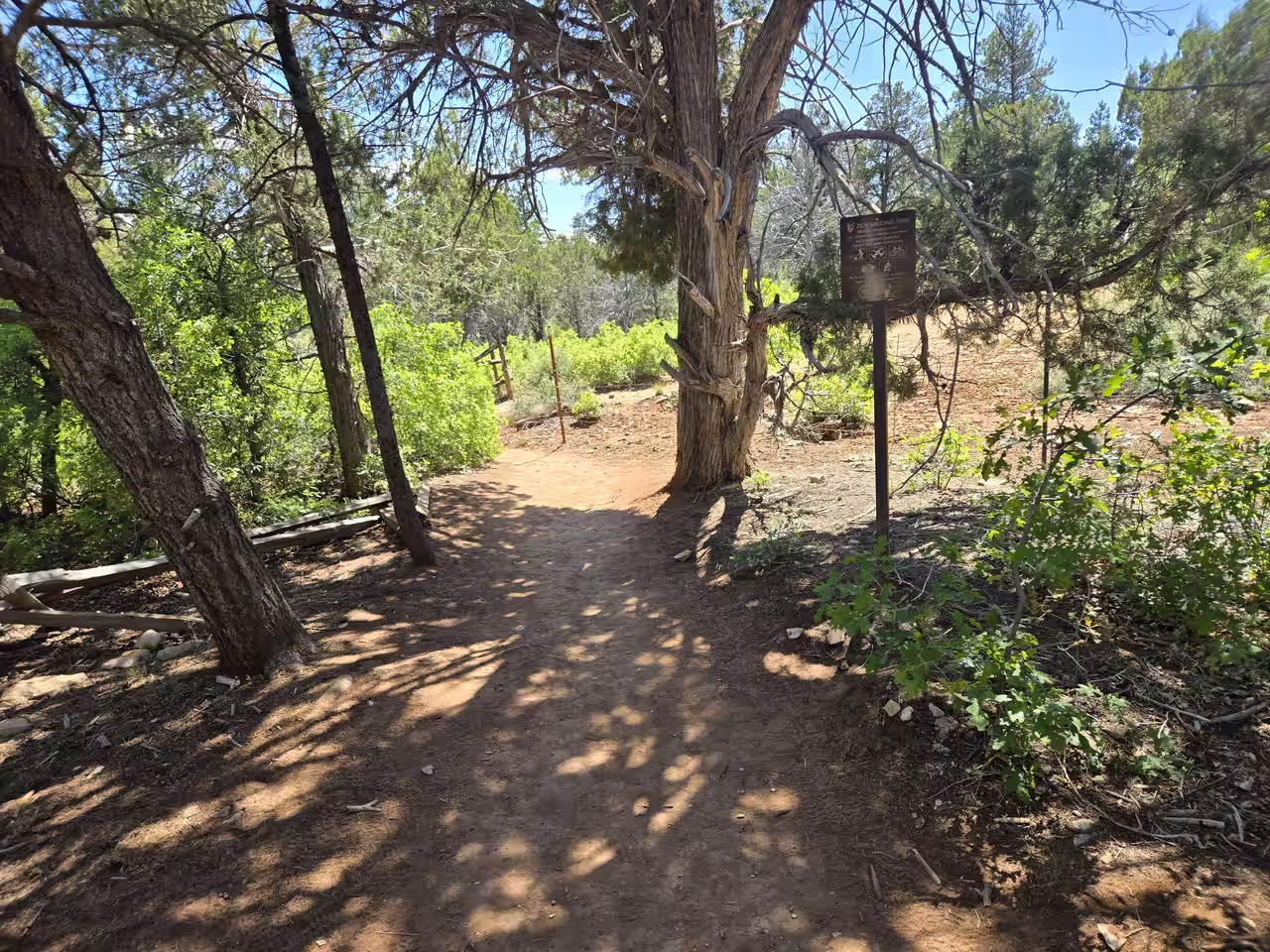
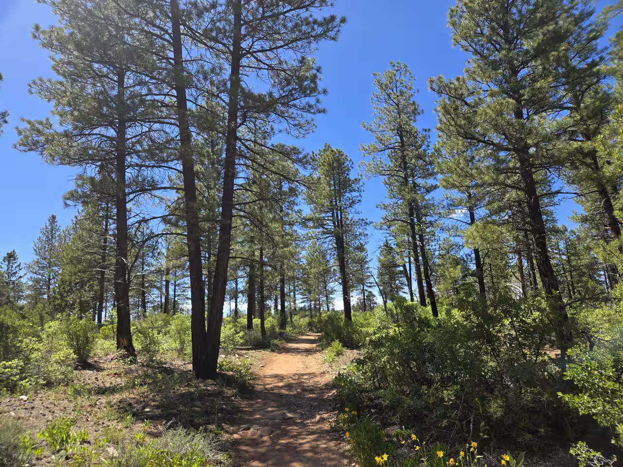
The first half is shaded and easy — tall ponderosas overhead, soft sandy trail underfoot, almost no elevation change. This is the section where the "flat and boring" reputation comes from, but it's also where you get the most relief from the sun, which matters more than scenery if you're hiking in summer heat.
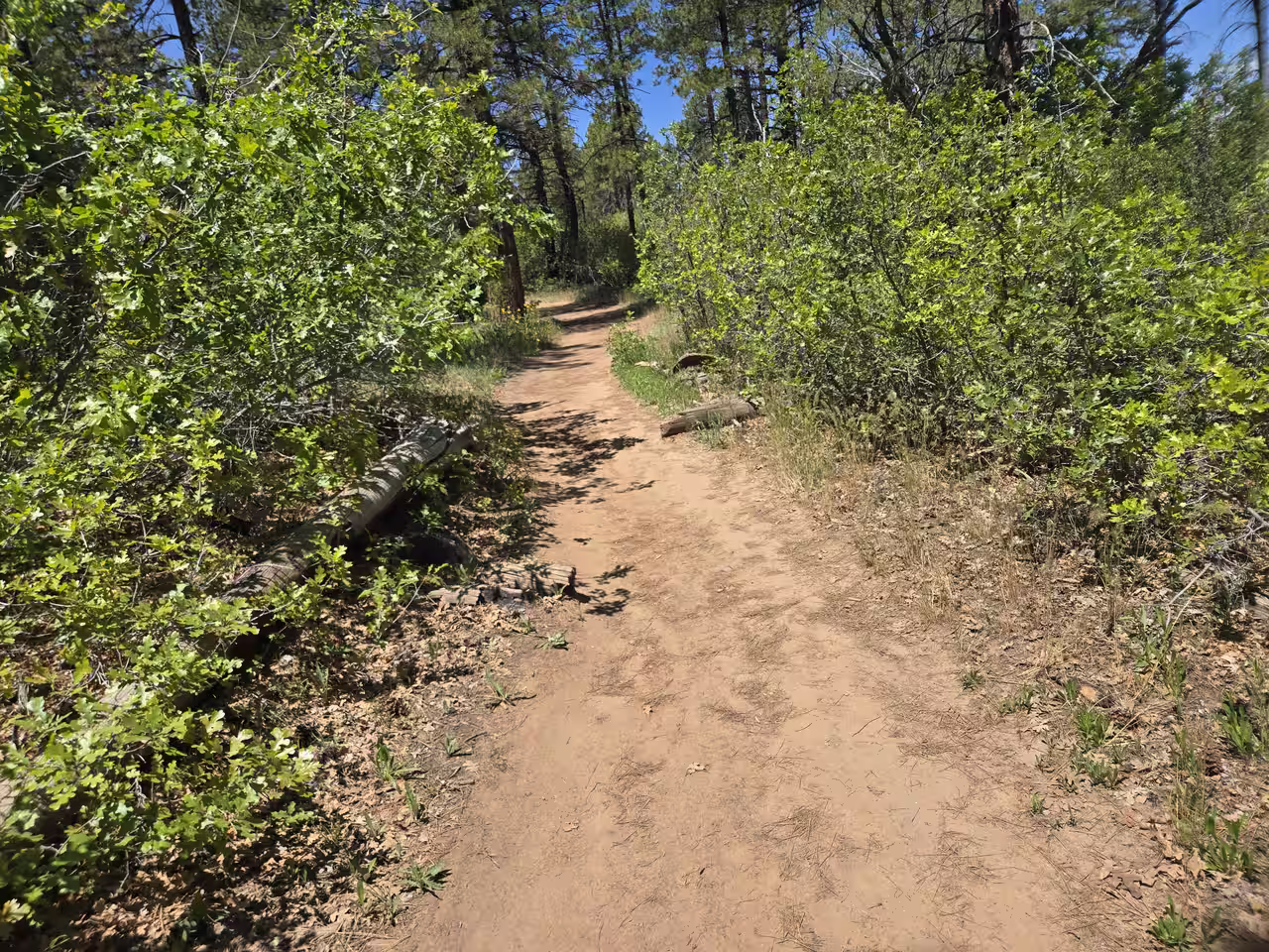
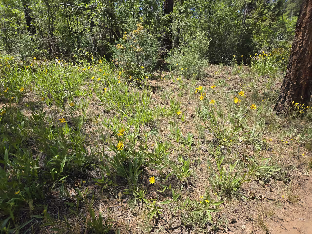
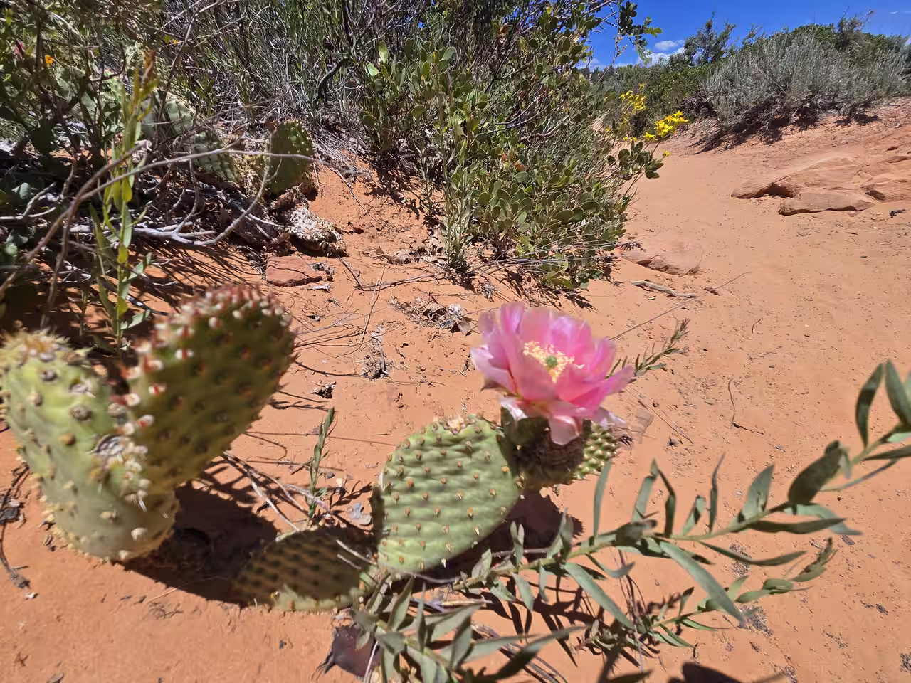
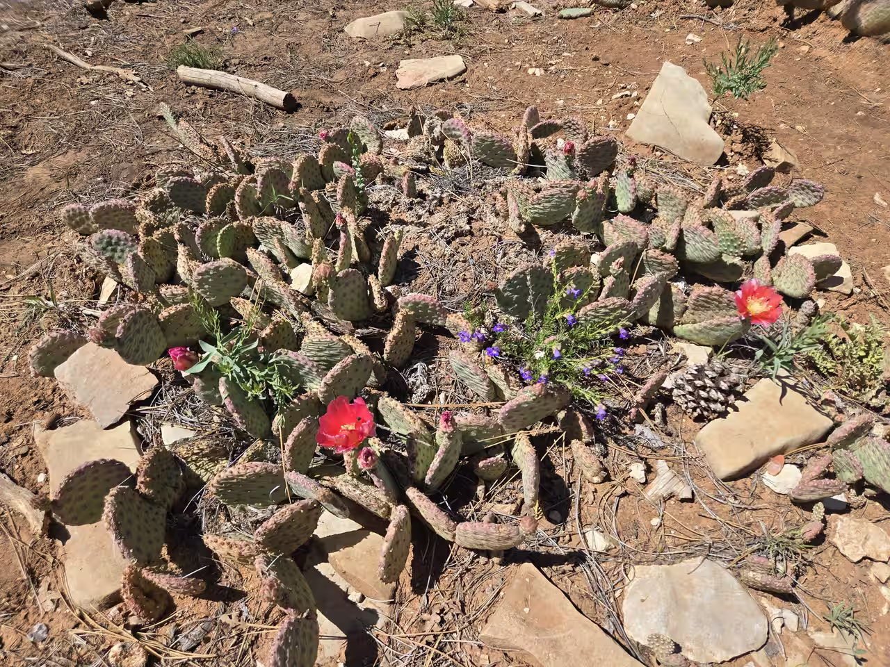
Then the trail tightens into scrub oak singletrack before opening back up into sandy desert terrain — yucca, sagebrush, and prickly pear cactus along the edges of the path. Late May had several varieties blooming when we went: yellow arrowleaf balsamroot in the meadow clearings, creamy yucca blossoms, and bright pink prickly pear flowers right at trail's edge.
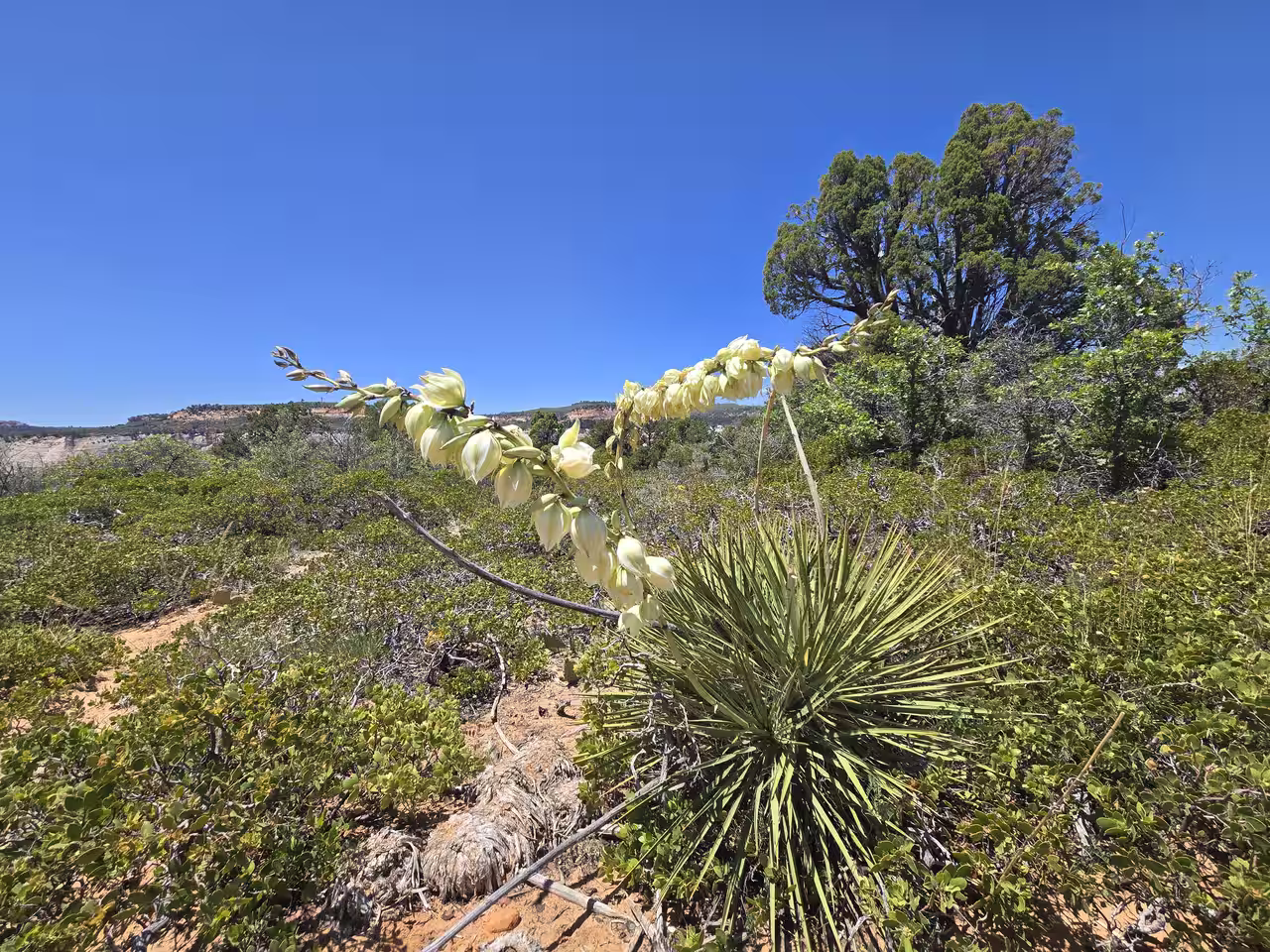
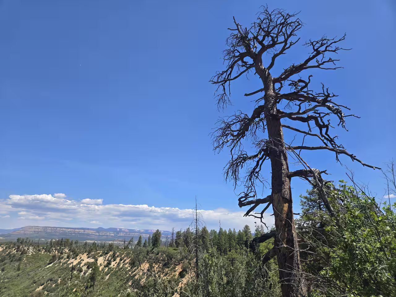
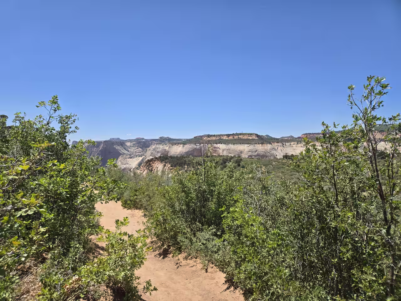
The desert stretch is also where the sand gets noticeably hotter underfoot in the afternoon — more on that below. Eventually the trail crosses back into a more open mesa meadow, and the first real glimpses of the canyon start appearing through gaps in the trees before the final approach to the rim.

Is It Family-Friendly?
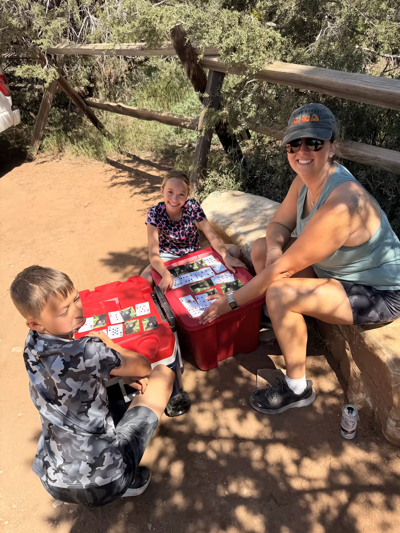
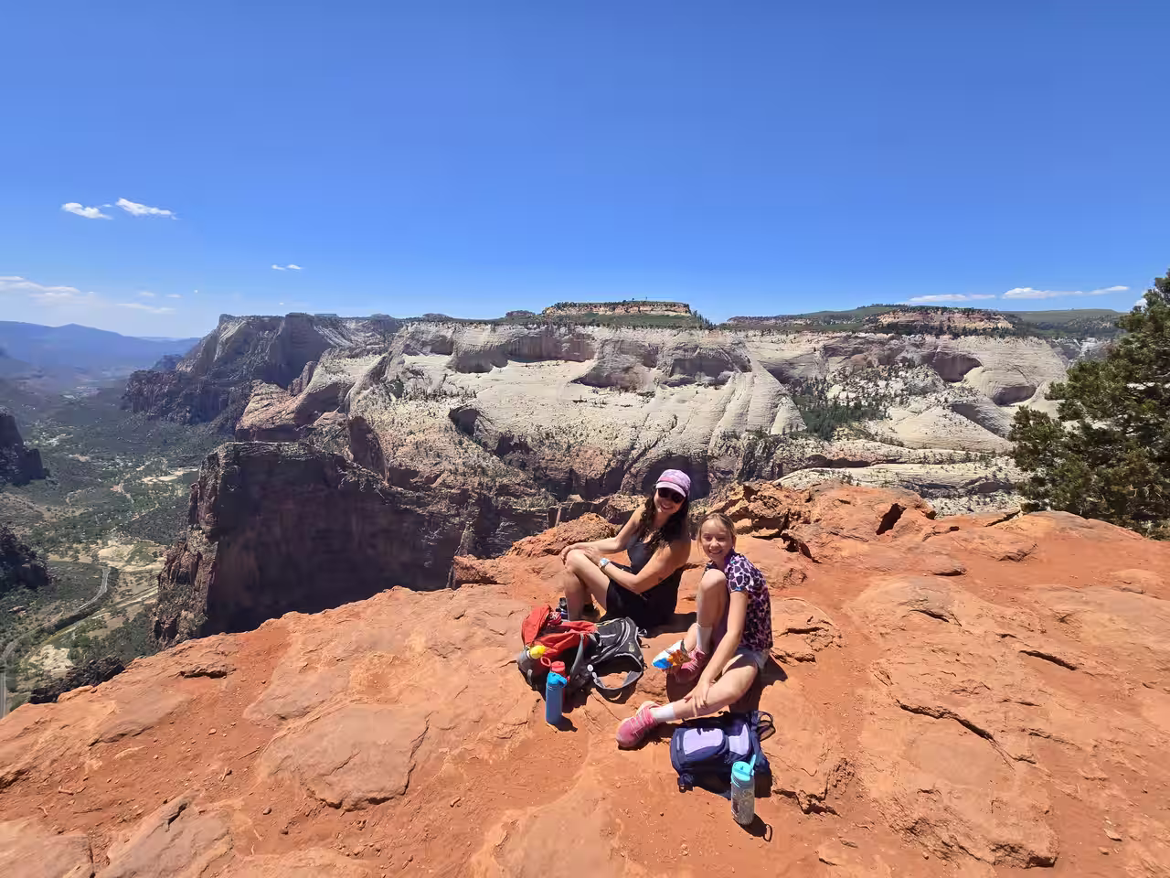
We did this with our kids, ages 10 and 13, on Memorial Day weekend. Most of the distance is genuinely easy — flat, sandy, no technical footing. A handful of short, steeper switchback sections show up before the final approach, but nothing that stopped the kids or required real scrambling. At a relaxed family pace, this is one of the more approachable "big view" hikes in the entire park, especially compared to anything involving Angels Landing's chains or a permit lottery.
Water, Timing & What to Wear
We started late morning and finished mid-afternoon, which worked fine for a Memorial Day weekend trip but isn't what we'd recommend for June through August. The first half, shaded under pines, stays cool. The desert-scape middle section gets genuinely hot once the afternoon sun is overhead — the sand itself heats up underfoot in a way that's easy to underestimate.
On water: each of us carried a bottle with electrolyte mix, plus we had a backup CamelBak that we ended up dipping into. It was enough for a Memorial Day pace, but our own takeaway is to bring more than you think you'll need if you're going in summer, and to start earlier in the day — both to beat the heat and to give yourself margin if the desert stretch runs hotter than expected.
Footwear-wise, real hiking boots are ideal given the sand and occasional loose rock, but the terrain isn't technical enough to require them — any broken-in, comfortable shoe will get you there and back.
Wildlife Along the Way
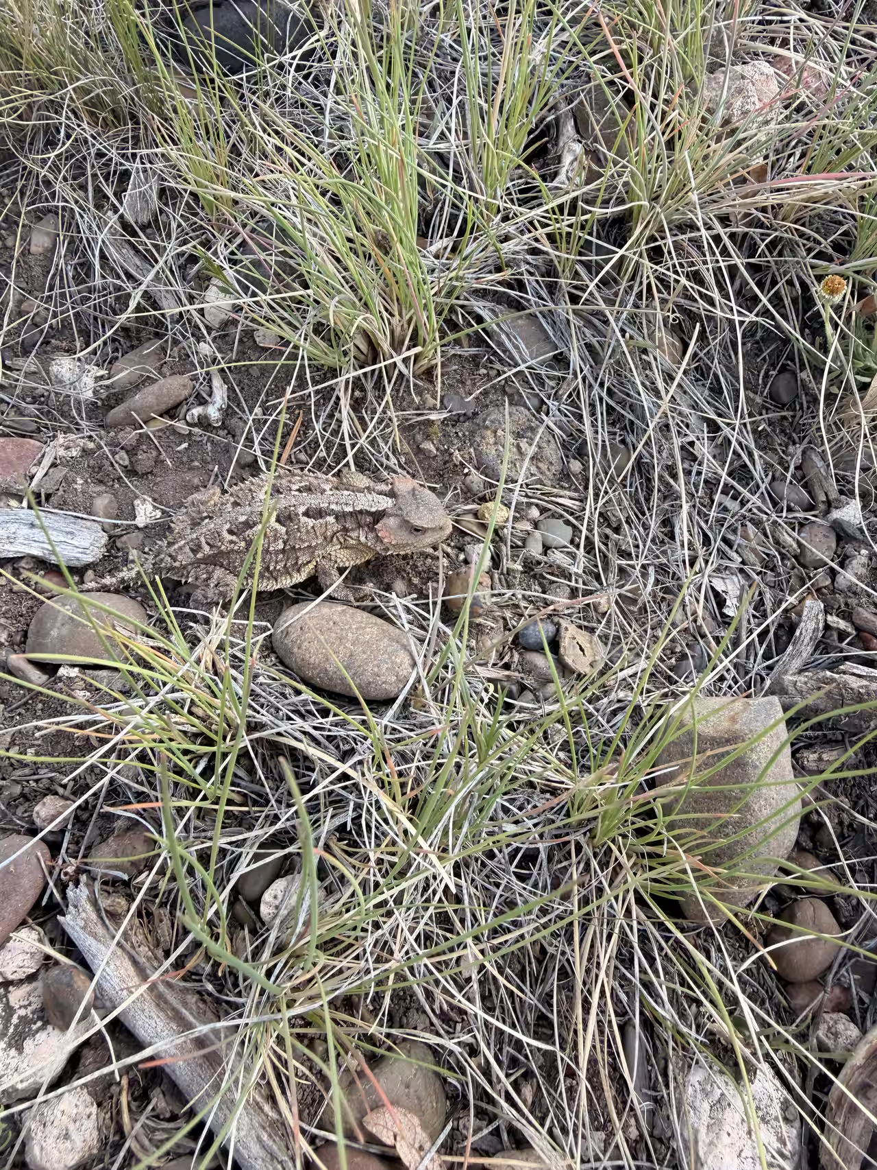
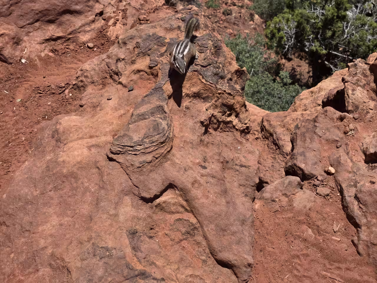
Keep an eye on the ground, not just the views. We spotted a horned lizard so well camouflaged against the rocky trail that we almost stepped past it, and chipmunks were common around the rim itself, clearly used to hikers stopping for a snack break. The NPS trailhead sign also flags mountain lions in the area — standard backcountry caution applies, but nothing that should change your plans.
The Payoff — What You Actually See
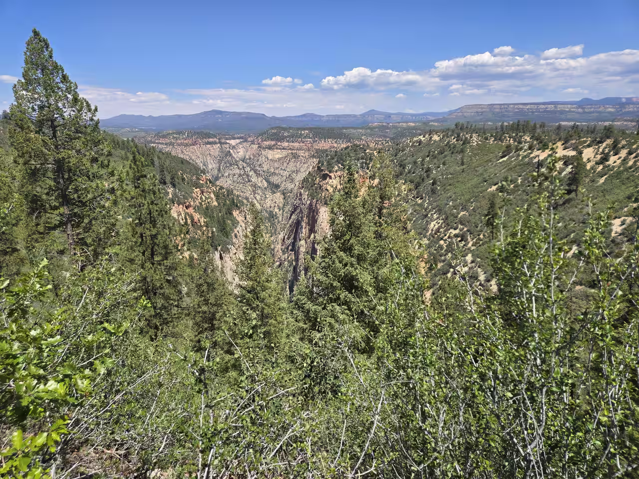
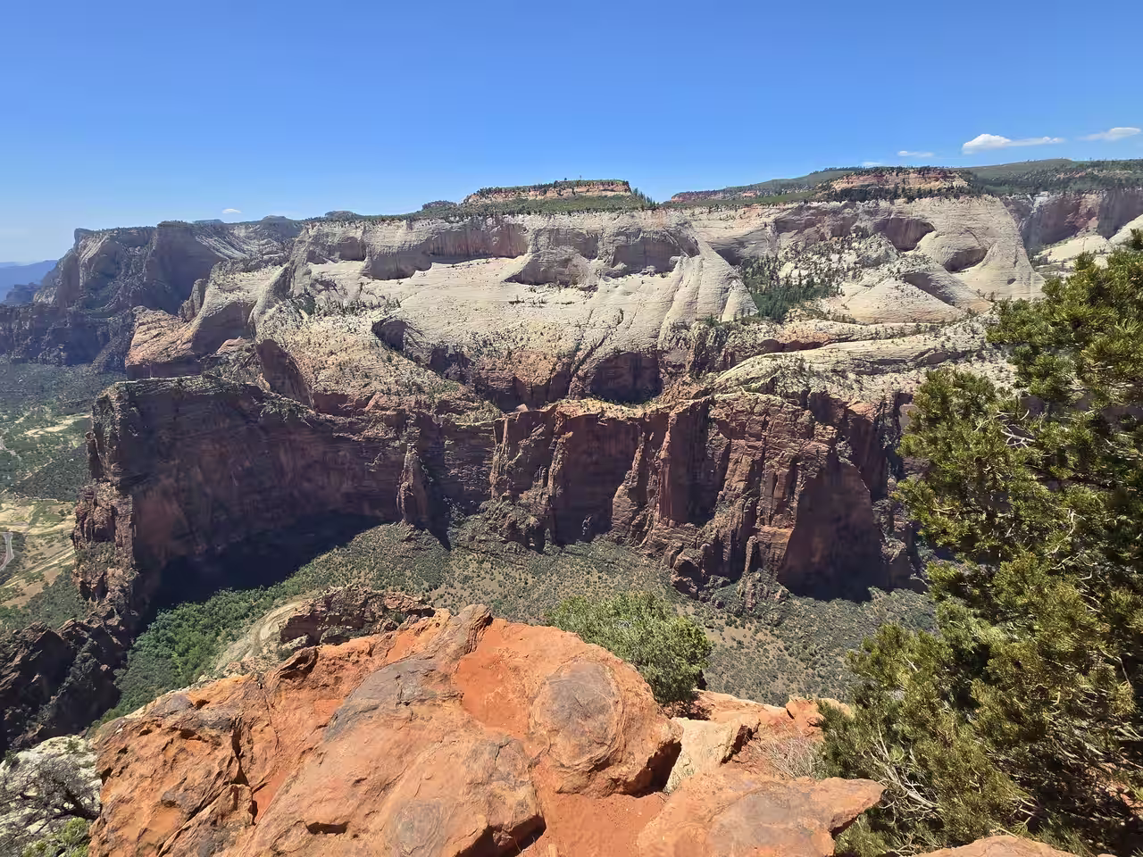
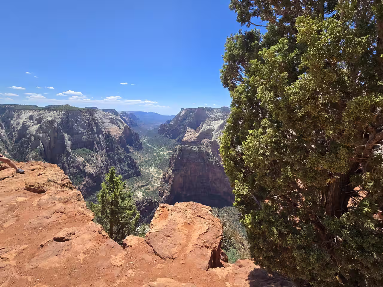
The trees fall away and the trail spits you out right at the canyon edge, with almost no warning. You're standing 2,000 feet above the floor of Zion Canyon, looking straight down the length of it. Angels Landing — the hike everyone fights a permit lottery for — looks small from up here. The Virgin River and the Zion Canyon Scenic Drive are both visible threading along the bottom. Great White Throne fills the skyline to the south.
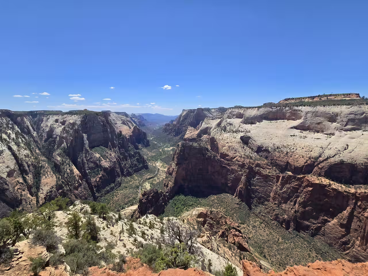
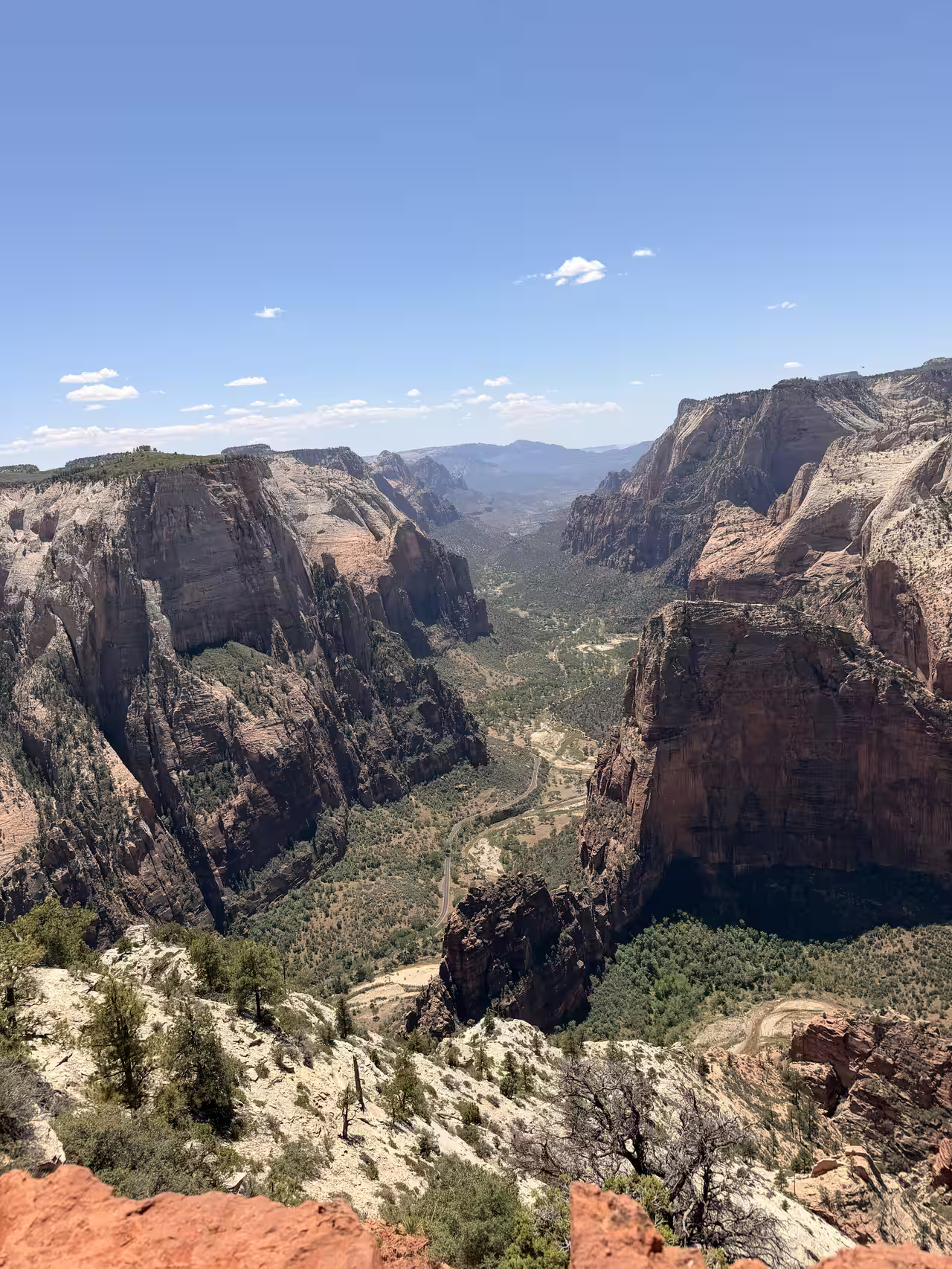
It's worth wandering a bit along the rim once you arrive — different vantage points a few hundred feet apart give meaningfully different framing, from the deep narrow side-canyon views to the broader sweep down the main canyon.
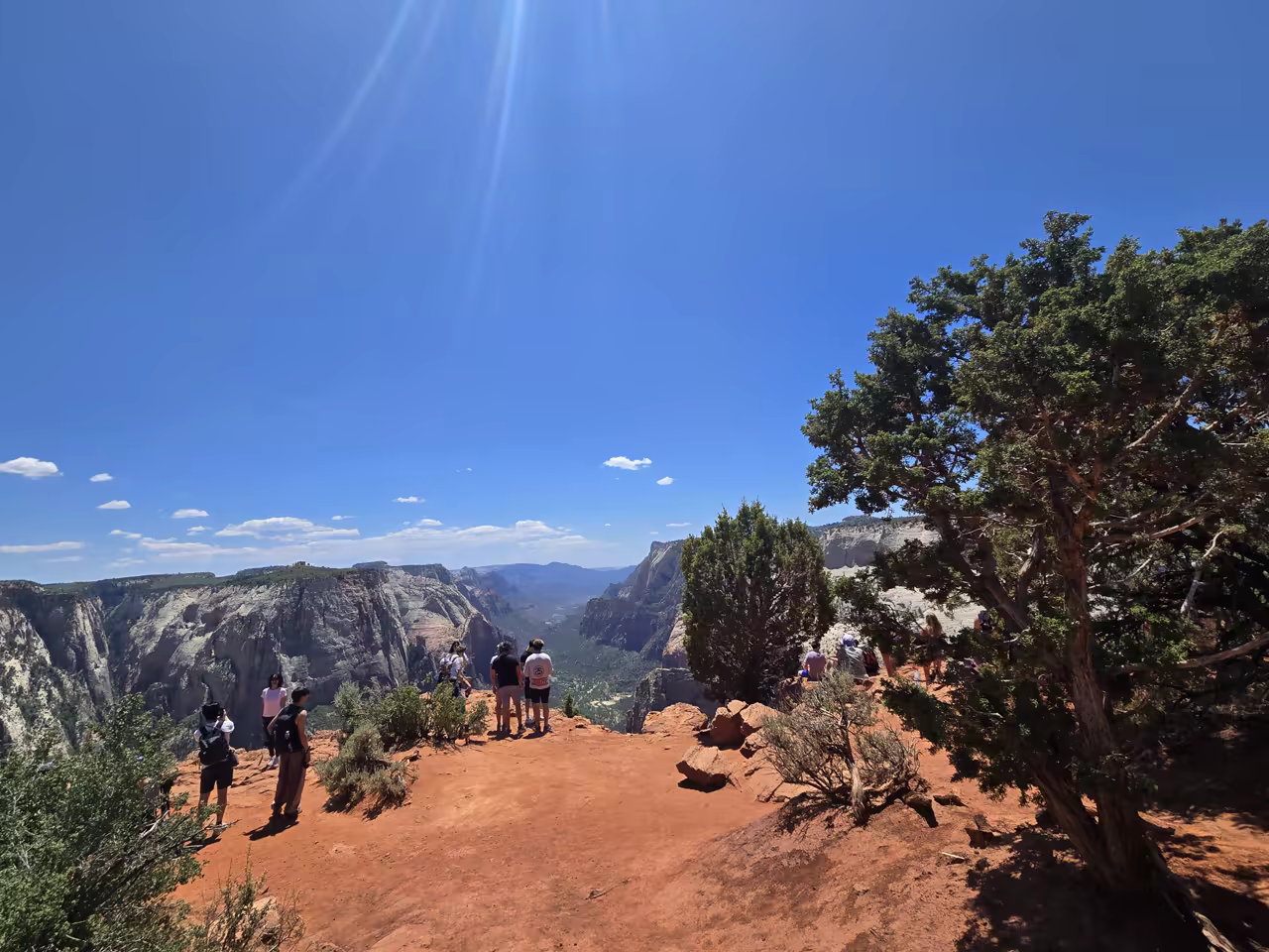
How Crowded Does It Get?
We were there on Memorial Day weekend — the single busiest weekend of the year — and it still didn't feel overwhelming. There were enough people that you'd take turns finding a clear spot for a family photo facing the canyon, but nothing like the bottleneck you'd hit at Angels Landing's chains or the Narrows' entrance. The access-road hassle does real work filtering out casual visitors, which is exactly why this trail still feels comparatively quiet even at peak times.
Rules You Need to Know Before You Go
Zion Wilderness Regulations
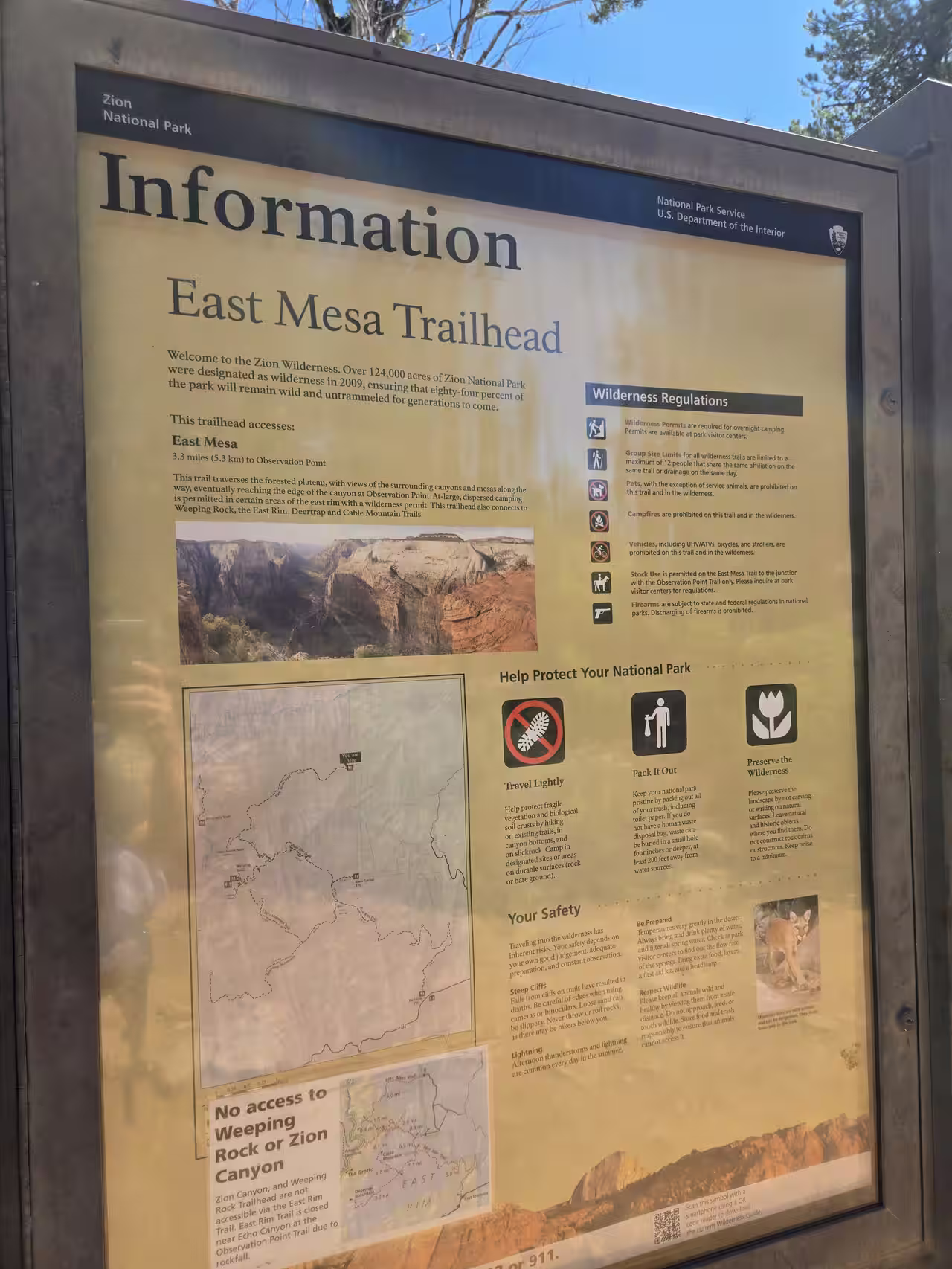
The East Mesa Trail falls inside Zion's designated wilderness, and the rules are stricter than a typical day-hike trail. No pets are allowed — service animals only, so this isn't a fit if you were hoping to bring the dog along for once. No campfires anywhere along the trail or in the wilderness. No bikes, strollers, or any wheeled vehicles including UHVs and ATVs. Group size is capped at 12 people sharing the same trail or drainage on the same day. None of this applies to a normal day hike to the viewpoint and back, but it's worth knowing if your plans involve anything beyond that.
Overnight camping anywhere along the east rim requires a wilderness permit from a park visitor center — this trailhead does connect onward to Deertrap, Cable Mountain, and (when reopened) the East Rim Trail, for anyone planning a longer backcountry trip.
When to Go
Afternoon thunderstorms are common nearly every summer day in this part of Utah, and the exposed rim at Observation Point is not where you want to be when one rolls in. Aim for an early start regardless of season, both to beat the heat on the desert-scape middle section and to be well off the exposed rim before any afternoon storm activity develops.
Late spring (May) and fall both offer the best combination of comfortable temperatures and active wildflowers or fall color. Summer is entirely doable — we did it over Memorial Day weekend without issue — but plan for an earlier start than we gave ourselves, and bring more water than feels strictly necessary. Winter access depends heavily on recent precipitation; the same dirt road that turns to "death mud" after rain becomes genuinely hazardous with snow or ice, so check conditions before committing to a winter visit.
Book Your Basecamp
Observation Point, Angels Landing, the Narrows — Starlit Ridge puts you about an hour from the East Mesa Trailhead and even closer to Zion's south entrance. Book direct for the best rate.