Starlit Ridge is the perfect launch point for mountain biking and road cycling — with Dixie National Forest trails, a world-class bike park, and some of Utah's most scenic roads right at your door.
Singletrack & Dirt Roads
Mountain Biking Trails
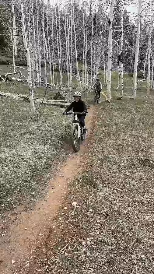
The Dixie National Forest surrounding Starlit Ridge offers a wide variety of singletrack and dirt road riding. Elevations range from 8,000 to 10,000+ feet, with cooler summer temperatures making conditions ideal when lower elevations are scorching.
Duck Creek Trail Network
Beginner–ModMTB12.5 mi away
A network of forest roads and informal trails around Duck Creek Village. Ideal for beginners and intermediate riders with forested scenery and minimal traffic.
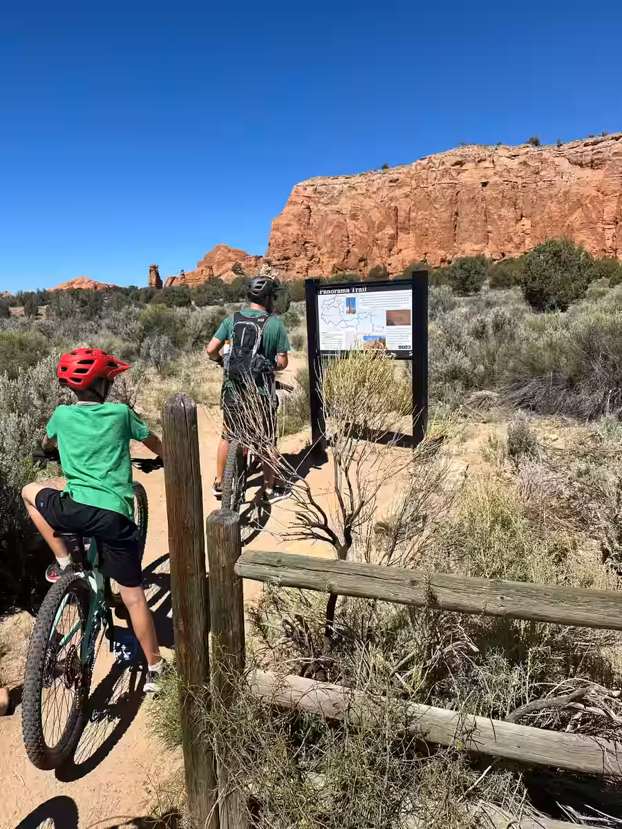
Navajo Lake Loop
EasyMTB19.7 mi away
Flat to rolling terrain around a stunning 9,000 ft alpine lake. A relaxed ride with incredible scenery — bring a fishing rod for post-ride relaxation. ⚠️ Note: Last reports indicate significant fallen trees on the trail — check current conditions with your host before riding.
Forest road riding above Bryce Canyon with sweeping views across the plateau. Pine and aspen forests provide shade and spectacular fall color.
⚡ Thunder Mountain Trail
IntermediateMTB~33 mi away
One of Utah's most iconic mountain bike trails. Riders descend through orange dirt, hoodoos, and ponderosa forest with sweeping Bryce Canyon scenery. Often done as a shuttle ride for a long, flowing downhill.
🌿 Raven & Roadrunner Trails — Kanab
Easy–IntermediateMTB~44 mi away
Short desert singletrack loops on the north edge of Kanab. Flowy riding through juniper and sandstone with small rollers and mild climbs — great for a quick ride or beginner-friendly singletrack.
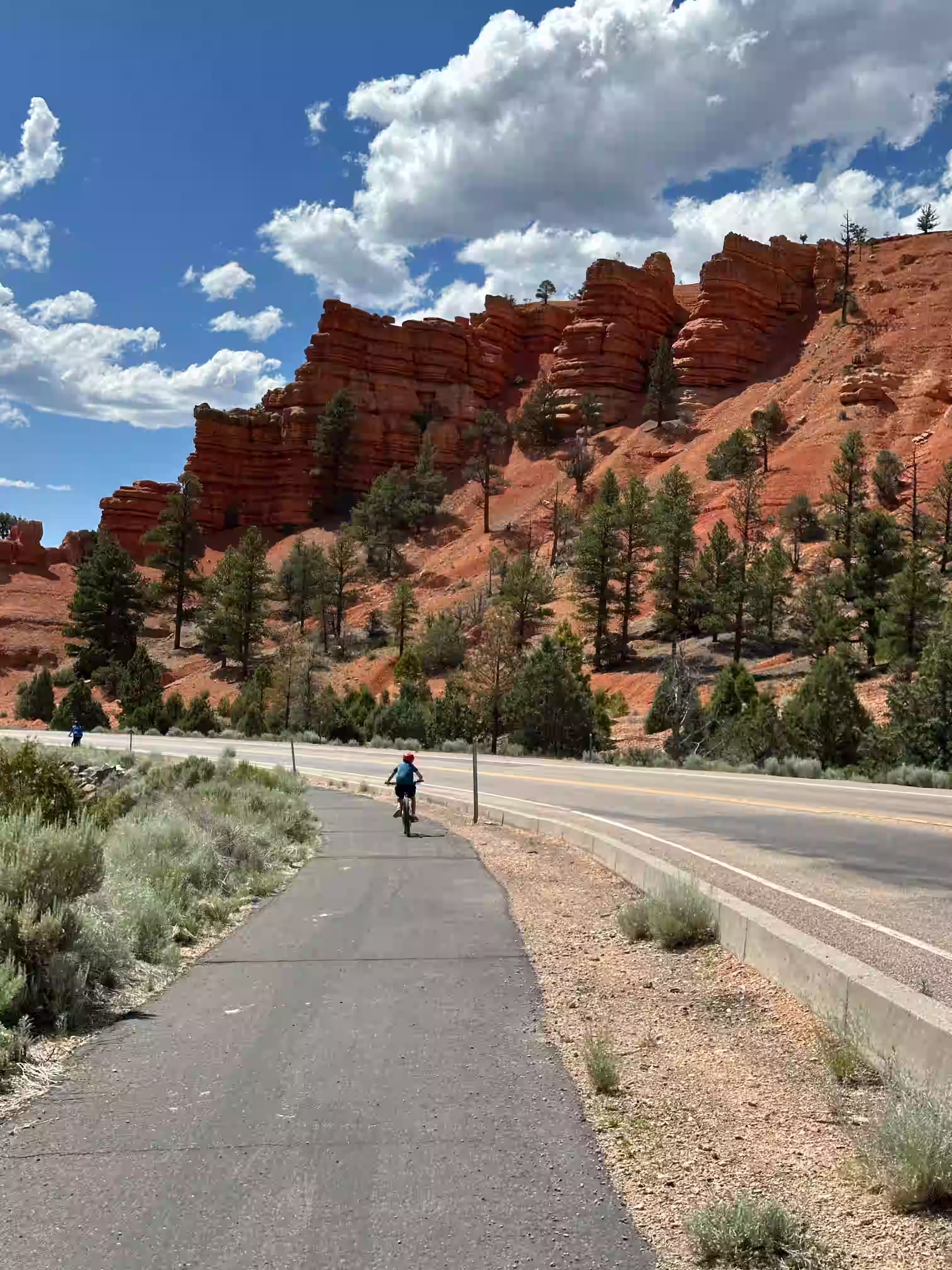
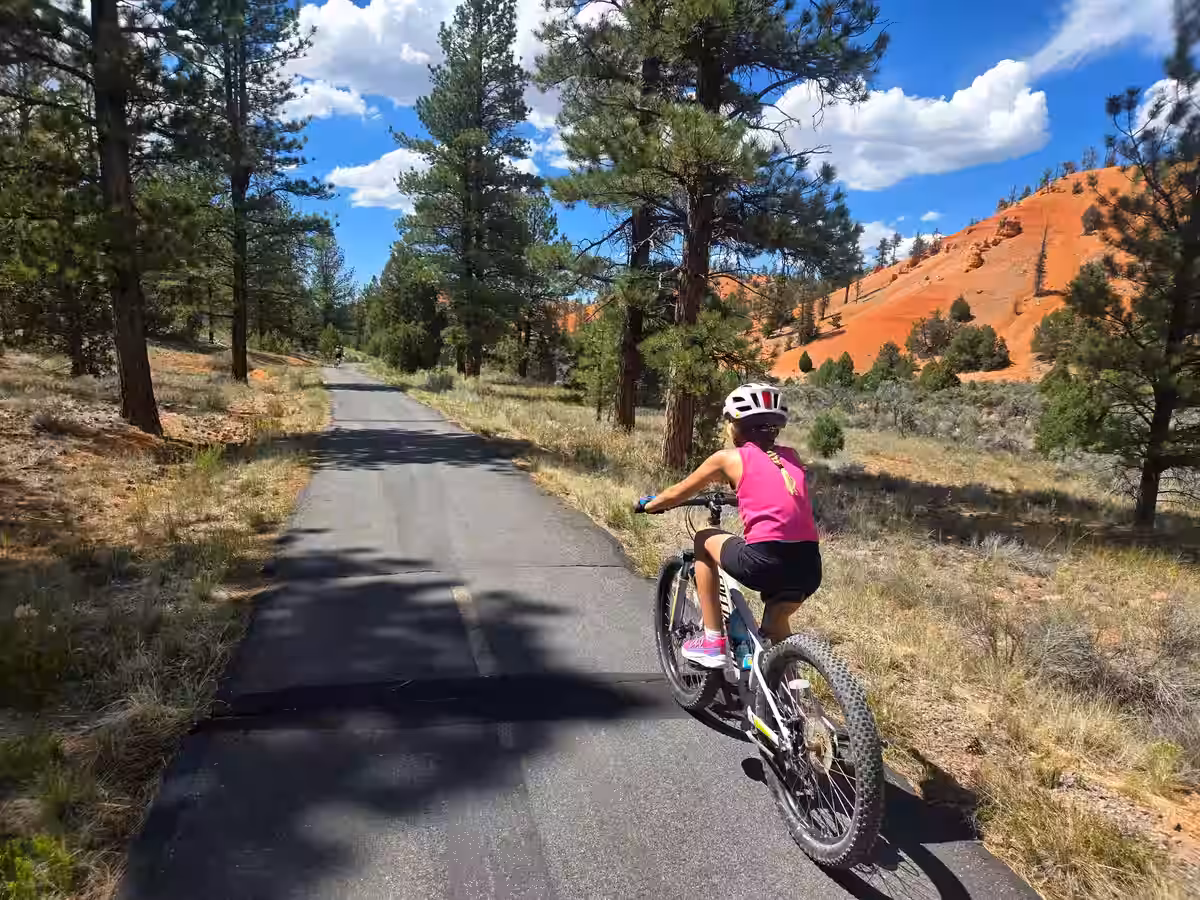
🧡 Red Canyon Paved Bike Trail
Easy25.6 mi awayFamily Friendly
An 8.6-mile paved shared-use trail through Red Canyon — towering red hoodoos, ponderosa pines, and pink limestone walls the whole way. Gentle grades with marked lanes. Connects to the Bryce Canyon Multi-Use Path for a 20-mile point-to-point into the national park. The downhill back is fast and fun. Season: late April through mid-November.
Red Canyon MTB
Red Canyon Scenic Drive
Brian Head Bike Park
All LevelsMTB36.5 mi away
A lift-served bike park at 10,000+ ft with beginner to expert downhill trails. Rentals and lessons available on-site at Brian Head Resort.
🌳 Applecross Trail System
All LevelsMTB~60 mi away🆕 Newly Built
35 miles of purpose-built singletrack just outside Zion's east entrance — green to black diamond with berms, jumps, and wood features. Upper trailhead has toilets and water. Season: late May–October.
🌍 Gooseberry Mesa
Intermediate–ExpertMTB~65 mi away
30+ miles of slickrock and juniper singletrack southwest of Zion with jaw-dropping canyon views. South Rim is black diamond; White Trail is a beginner-friendly 7-mile out-and-back. No water on trail — pack it in.
⛳️ Virgin River Rim Trail The Big One
Intermediate–AdvancedMTB~11 mi — Strawberry Point
A 30+ mile high-alpine epic hugging the Pink Cliffs of the Markagunt Plateau. The views into Zion and the Virgin River headwaters are arguably the best of any trail in the state. Most riders shuttle from Strawberry Point down to Woods Ranch — or do out-and-back runs from the Strawberry trailhead for a taste of the rim.
The legendary "outside the park" shuttle run at Brian Head. Drops thousands of vertical feet from the summit down to Panguitch Lake through thick aspen groves — fast, flowy, and widely considered the best singletrack descent in Southern Utah. Shuttle from the top and let gravity do the work.
If Bunker Creek is the flowy cousin, Dark Hollow is the technical one. An 11-mile descent starting at 11,000 ft, dropping from sub-alpine forest into high-desert red rock scrub. World-famous for its variety of terrain and challenge. Not for the faint of heart — but unforgettable.
A specific 6-mile singletrack loop near Duck Creek that's much more MTB-focused than the general forest roads. Great for a quick morning spin when you don't want to commit to a full-day epic — purpose-built flow trail feel through the pines.
Light traffic, dramatic elevation changes, and breathtaking scenery make the roads surrounding Starlit Ridge a bucket-list destination for cyclists.
Zion Canyon by Bike
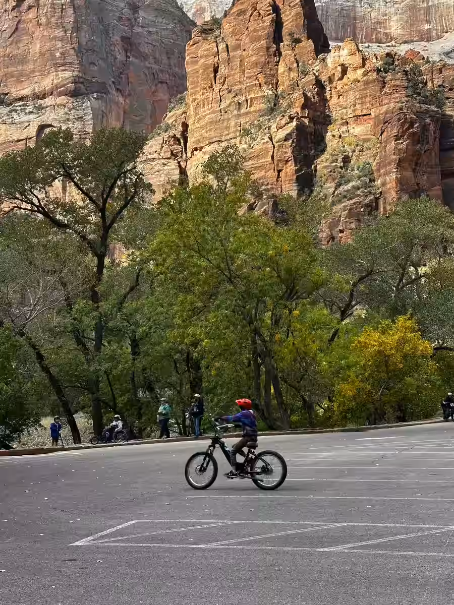
🏘️ Zion Canyon Scenic Drive
Easy–ModRoad42.6 mi away⭐ Must-Do
The main event for cycling in Zion. The 7-mile Scenic Drive is closed to private cars during peak season — bikes share the road only with the park shuttle. Start on the Pa'rus Trail from the Visitor Center, then ride all the way to the Temple of Sinawava. 15 miles round-trip, only 300 ft of gain.More ⌄
The 7-mile Zion Canyon Scenic Drive is closed to private cars during peak season (March–November) — so bikes share the road only with the park shuttle bus. Start on the flat, paved Pa'rus Trail (1.75 mi) from the Visitor Center along the Virgin River, then continue up the Scenic Drive all the way to the Temple of Sinawava at the mouth of the Narrows. The whole trip is 15 miles round-trip with only 300 ft of elevation gain. Pro tip: load your bike onto the shuttle at the Visitor Center (each bus carries 3 bikes), ride up to Temple of Sinawava for free, then coast the whole way back down. Pull over and stop completely when a shuttle approaches from behind — they cannot pass a moving bike.
★ UT-14 Corridor — Southern Utah's Premier Road Climb
Moderate–HardRoad40 mi total
Southern Utah's premier road climb and part of U.S. Bicycle Routes 70 & 79. The route follows SR-14 for 40 miles from Cedar City to Long Valley Junction — essentially your front door at Starlit Ridge. Expect a steep climb through Cedar Canyon, a long ascent through pine and aspen forest, and a top-out near 9,900 ft before rolling descents toward the valley. Fill up in Cedar City — services are sparse until Duck Creek Village at the midpoint.More ⌄
USBR-70 & 79 One of southern Utah's premier road cycling climbs and part of the U.S. Bicycle Routes 70 and 79. The route follows SR-14 for 40 miles from Cedar City to Long Valley Junction — essentially your front door at Starlit Ridge. Expect a steep early climb through Cedar Canyon, a long ascent through dense pine and aspen forest, then a top-out near 9,900 ft before rolling descents toward the valley. The road is in excellent condition with sweeping views at every turn. Services are sparse — fill up in Cedar City before heading out and stop at Duck Creek Village (midpoint) for water. Watch for fast-moving traffic and some narrow shoulders through the canyon section. Best season: June through early October. Expect cooler temps and possible storms at elevation.
Starlit Ridge — East Ridge Climb
Easy–ModMTBOn Property
MTB the back ravine or ride N Ridge Road up to East Ridge — the highest point on the east side of the property with sweeping canyon country views. Explore Starlit Ridge's 33 acres at ~8,000 ft right from your cabin.
The easiest and most fun way to experience Zion Canyon — no shuttle lines, no crowds, just you and the canyon walls. Rent from Zion Peddler (0.4 mi from the park entrance), ride the Pa'rus Trail along the Virgin River, then continue up the Scenic Drive all the way to Temple of Sinawava. With pedal assist, anyone can handle the uphill with ease — no fitness required.More ⌄
The easiest and most fun way to experience Zion Canyon — no shuttle lines, no crowds, just you and the canyon walls. Rent from Zion Peddler (🌐 zionpeddler.com · 358 Zion Park Blvd, Springdale), located just 0.4 miles from the park entrance with a large lot and fleet of 100 bikes in 12 colors. Park your car there, sign a waiver, take a quick bike class, grab a helmet, and ride straight in. Start on the flat, paved Pa'rus Trail (1.75 mi) along the Virgin River — open to bikes and pedestrians with 360° canyon views — then continue up the Zion Canyon Scenic Drive all the way to the Temple of Sinawava. The road is closed to private cars in peak season (March–November) so you'll share it only with the shuttle bus. With pedal assist, anyone can handle the uphill with ease — no fitness required. Pro tip: Book in advance — bikes go fast in peak season.
Zion Canyon by Bike 🎬
US-89 Scenic Byway
Easy–ModRoadVaries
A long, gently rolling highway through the heart of southern Utah. Ride north toward Bryce or south toward Kanab with stunning canyon and mesa views.
Kodachrome Basin
Zion–Mt. Carmel Highway
HardRoad~24 mi one way
One of Utah's most dramatic road cycling experiences — through tunnels, switchbacks, and slickrock scenery leading into Zion National Park. Advanced riders only.
🏔️ Mammoth Creek Road The Quiet Connection
Easy–ModerateGravel / Road~10 mi north
A low-traffic back road connecting US-89 to Duck Creek (UT-14) through a beautiful valley following Mammoth Creek. Far quieter than the main highways with a gentler grade through ranch land and lava flows. Perfect for a long, scenic gravel or road ride — and a great way to link a loop from the cabin.